Understand the Manali Leh highway trip in detail: approximate distances between landmarks, the altitude of every pass, checkpoints, fuel and food points, what changed after the Atal Tunnel, and the unwritten rules of driving this high mountain road.
A Manali Leh highway trip follows one of the highest motorable roads in the world, a lifeline kept open by the Border Roads Organisation for a few months each year. This article is about the highway itself: where each landmark falls, how high the passes really are, where to find fuel, food and checkpoints, and the etiquette that keeps traffic moving on narrow roads. Use it alongside a day-wise plan. All kilometre figures are approximate and measured from Manali via the Atal Tunnel; road works and diversions change them slightly every year.
The Manali Leh highway trip in numbers
- Total distance: about 425–430 km via the Atal Tunnel.
- Highest point: Tanglang La, roughly 5,300 m.
- Lowest point: Manali, about 2,050 m.
- States and UTs: Himachal Pradesh up to Sarchu, Ladakh beyond.
- Season: usually late May or June to early or mid-October.
- Maintained by: the Border Roads Organisation.
Landmark-by-landmark distance chart
| Landmark | Approx. km from Manali | Approx. altitude | What you find |
|---|---|---|---|
| Atal Tunnel (south portal) | 25 | 3,000 m | 9 km tunnel to Lahaul |
| Keylong / Tandi | 70 | 3,100 m | Last reliable fuel at Tandi, ATM, hotels |
| Jispa | 90 | 3,200 m | Camps and hotels by the Bhaga river |
| Darcha | 95 | 3,350 m | Checkpoint, dhabas |
| Zing Zing Bar | 130 | 4,300 m | Tent dhabas, BRO camp |
| Baralacha La | 140 | 4,890 m | High pass, Suraj Tal nearby |
| Sarchu | 175 | 4,300 m | Camps, Himachal–Ladakh boundary |
| Gata Loops / Nakee La | 200–215 | 4,700 m | 21 hairpins, then the pass |
| Lachulung La | 235 | 5,050 m | Second-highest pass on the route |
| Pang | 255 | 4,600 m | Tent dhabas, army transit camp |
| More Plains / Debring | 275–305 | 4,700 m | High plateau; turn-off for Tso Kar |
| Tanglang La | 320 | 5,300 m | Highest point of the drive |
| Upshi | 370 | 3,400 m | Joins the Indus valley; checkpoint |
| Karu | 390 | 3,400 m | Fuel available again |
| Leh | 427 | 3,500 m | End of the highway |
How the Atal Tunnel changed the highway
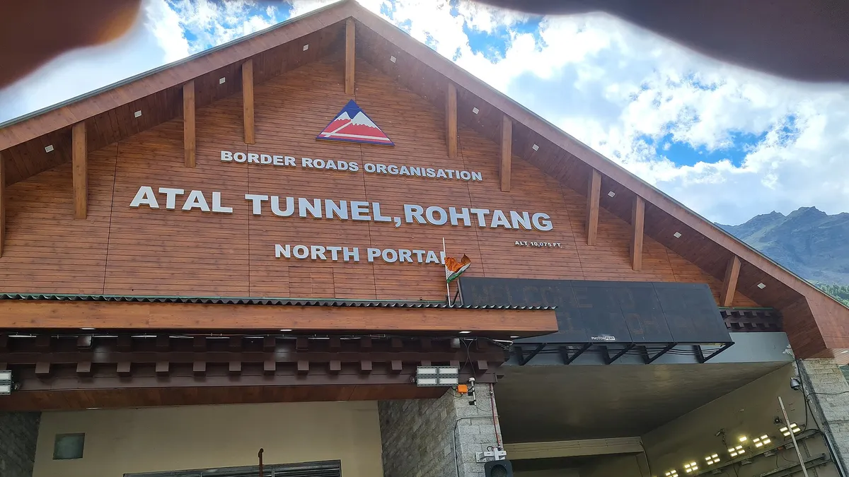
Before 2020, every Manali Leh highway trip began with the slow climb over Rohtang Pass, famous for traffic jams, mud and fog. The Atal Tunnel, about 9 km long, now runs beneath the Rohtang ridge and drops you into Lahaul in minutes. That has made the first day much shorter and more predictable, and it means you no longer need a Rohtang permit to reach Lahaul or Leh. The tunnel has speed limits and no stopping inside, so keep moving and switch on your headlights.
The three faces of the highway
Lahaul: green valleys and villages
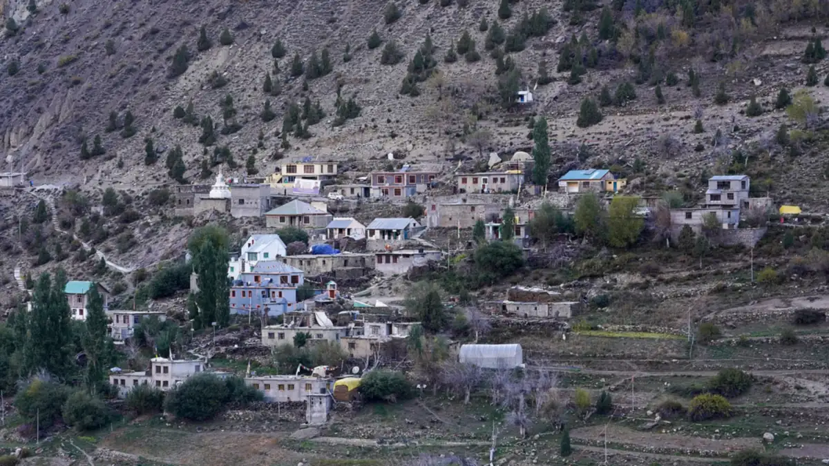
From the tunnel to Darcha, the highway runs through farmed valleys with willow trees, small monasteries and villages like Sissu, Gondhla, Keylong and Jispa. Road quality is mostly good, and there is network in towns.
The high passes: Darcha to Pang
This is the wild heart of the highway. Baralacha La, the Sarchu plains, the Gata Loops, Nakee La and Lachulung La follow one another with few facilities in between. Expect broken sections, water crossings, slush early in the season and very little mobile network.
Ladakh's plateau: Pang to Leh
After Pang the road climbs onto the More Plains, a wide flat plateau where you can finally drive in higher gears. Then comes the long climb to Tanglang La and the descent through Rumtse and Gya to Upshi, where the highway meets the Indus. The last stretch to Leh passes monasteries and villages along the river.
Stops worth making along the way
A highway this long is easy to treat as a race to Leh, but a few short stops add a lot to the experience without costing much time.
- Sissu: a waterfall and small lake just after the tunnel, good for a tea break.
- Keylong: the Lahaul district headquarters, with views of Kardang and Shashur monasteries across the valley.
- Deepak Tal and Suraj Tal: two lakes near Zing Zing Bar and Baralacha La, both visible from or close to the road.
- Sarchu plains: a vast, flat meadow surrounded by eroded cliffs, best in morning light.
- Gata Loops viewpoint: look back down the hairpins from the top.
- Pang canyons: sculpted sandstone pillars on the descent from Lachulung La.
- More Plains: watch for nomadic herders and their flocks in summer.
- Rumtse and Gya: the first Ladakhi villages after Tanglang La, with whitewashed houses and barley fields.
Keep every stop at high altitude short. Ten minutes at Baralacha La or Tanglang La is plenty; lingering is how headaches begin. Save longer breaks for Sarchu, Pang and the villages below Tanglang La.
Highway etiquette and safety
- Uphill traffic has priority on narrow sections.
- Army convoys always get right of way; wait for a safe straight to overtake.
- Horn on blind bends, especially on the Gata Loops and near Baralacha La.
- No stopping on hairpins or in avalanche-prone zones marked by BRO.
- Respect BRO crews; wait when they signal and thank them as you pass.
- Carry your rubbish out. There is no waste collection in the high section.
Fuel, food and network on the highway
Fill your tank at Tandi; the next reliable fuel is near Karu, roughly 365 km later. Tent dhabas at Zing Zing Bar, Bharatpur, Sarchu, Pang and near Tanglang La serve simple food and tea. ATMs exist in Keylong and Leh only. Mobile network fades after Darcha and returns around Upshi, so download offline maps and tell family when to expect your next call. Postpaid connections work best once you reach Leh.
Planning your Manali Leh highway trip
June offers snow walls and fresh scenery, July and August are busiest, and September is the calmest. Check the Manali Leh road condition guide for month-wise terrain, and our broader Manali to Leh travel guide for permits, transport and packing. Riders should also read Manali to Leh by bike for terrain-specific technique.
Altitude basics
Climb in stages, sleep at Jispa or Keylong on the first night if you are new to altitude, drink plenty of water and avoid alcohol. If anyone develops a severe headache, vomiting or breathlessness at rest, stop climbing and descend. Consult a doctor before travel if you have heart, lung or blood pressure issues.
Coming from Delhi?
Most people reach Manali by overnight bus or by driving via Chandigarh and Mandi. If you plan to drive all the way, our Delhi to Leh road trip article covers the plains section and how to break the journey.
Why travel the highway with Tripsdoc
Our drivers drive this highway every week of the season. They know which streams rise in the afternoon, where the good dhabas are and how to handle checkpoints quickly. Before each departure we check the latest status of Baralacha La and Tanglang La with people on the ground, so you are not relying on week-old news, and we brief every traveller on altitude, clothing and what to expect on each day. We plan halts at sensible altitudes, keep buffer time for closures and stay in touch with drivers on the road for real-time updates.
Conclusion
Knowing the landmarks, passes and rules of the road turns a Manali Leh highway trip from a long, uncertain drive into a journey you can actually enjoy. Keep this chart handy, fill up at Tandi, respect the convoys and BRO crews, and give your body time at each stage. Ready to go? Explore our Leh Ladakh tour packages or contact Tripsdoc to plan your drive.
Photo credits (Wikimedia Commons): Jagseer S Sidhu (CC BY-SA 4.0), Timothy A. Gonsalves (CC BY-SA 4.0), McKay Savage from London, UK (CC BY 2.0).
Frequently Asked Questions
The Border Roads Organisation (BRO) builds and maintains the road, clears snow at the start of each season and repairs landslides through the summer. Their signboards, often with witty safety slogans, are a familiar sight. When you see BRO crews working, slow down, follow their instructions and be patient; they keep the road alive.
The Atal Tunnel, opened in October 2020, cut the Manali to Leh distance by roughly 45–50 km and saves a few hours compared with crossing Rohtang Pass. More importantly, it avoids the traffic jams and permit system that used to slow the climb to Rohtang. The rest of the highway beyond Lahaul is unchanged.
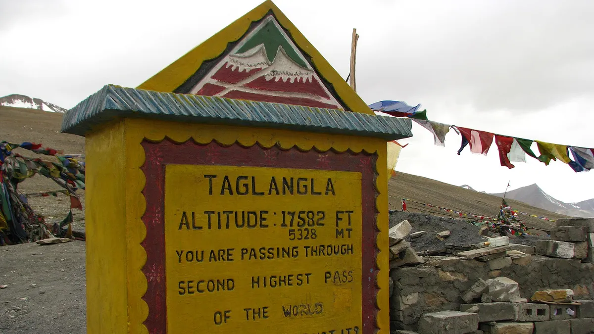
Tanglang La, at roughly 5,300 m, is the highest point on the Manali–Leh road. Lachulung La, just above 5,000 m, is second. Baralacha La and Nakee La are a little lower. Signboards at the passes sometimes show different altitude figures, so treat any single number as approximate.
Not for most travellers. The highway now goes through the Atal Tunnel below Rohtang. You can still drive up to Rohtang Pass as a sightseeing trip from Manali, but it needs a separate permit and is subject to vehicle limits. It is not required for reaching Lahaul or Leh.
Expect police or administrative checkpoints near the Atal Tunnel approaches and at Darcha, where vehicle and traveller details may be recorded, and a checkpoint near Sarchu at the Himachal–Ladakh boundary. There may also be checks near Upshi. Keep ID and vehicle papers handy; the process is usually quick.
Uphill traffic generally has right of way, because restarting on a steep climb is harder. Army convoys and heavy trucks also get priority. On narrow sections, the vehicle with an easier spot to pull aside should wait. Use your horn on blind bends and never stop on hairpins.
Yes. If you sleep at Sarchu, the Gata Loops come soon after you start, and you still reach Leh by evening. From Jispa it is a longer day, but you pass the loops by late morning. Stop only briefly on the straights between hairpins for photographs.
Beyond Lahaul, no. Heavy snow closes Baralacha La and Tanglang La from roughly late October or November until the BRO reopens the road, usually around May or June. Lahaul itself is reachable through the Atal Tunnel for much of the year, subject to snow and administrative advisories.
Facilities are basic. Dhabas and camps at Keylong, Jispa, Darcha, Zing Zing Bar, Bharatpur, Sarchu, Pang and near Tanglang La usually have simple toilets for customers. Between these points you will mostly rely on the open landscape, so carry tissue, sanitiser and a small bag to take your waste away.
Driving time is usually 14–18 hours spread over two days, depending on road works, convoys, weather and water crossings. Rarely can anyone drive it faster safely. Adding photography, tea breaks and a lunch stop, plan for 9–11 hours on the longer day and 6–8 on the shorter one.